Home » Bridge Area (Page 3)
Category Archives: Bridge Area
The Walker/Campbell/Crooker Home at 13 Webster

Campbell House front view undated

Campbell House side view 1920’s
Memories of the 1936 Flood

West Hollis and Bridge Streets 1936
The great flood of 1936 struck both the Nashua and the Hudson side of the Taylor Falls Bridge. By mid March the accumulation of winter snow to the north and west along with warmer weather and heavy rains caused the Nashua and Merrimack Rivers to peak beyond flood stage. The rivers were rising fast and carrying large ice cakes. Flood stage on the Nashua side was reached by Sunday, March 15 including flooding along East Hollis and Bridge Streets. For a short time the water receded and the danger seemed to have passed; but by Wednesday, March 18, there were threats of more heavy rain and warmer weather. The Merrimack River was again rising fast at a foot an hour. During the next few days flood conditions existed along Litchfield Road, Webster Street, Post Office Square at the bridge, and south of the square to Maple Avenue and parts of Riverside near Lowell Road. By Saturday, March 21, flooding had peaked, water began to recede and the worst was over. It wold take months to clean up and recover from the damage and debris left behind.
From her home at 1 School Street, atop Campbell Avenue, Hazel Buxton (Mrs. Paul) was able to observe much of the flood activity in Post Office Square and Webster Street. Hazel kept a diary during the three worst days of the flood. This diary was later transcribed and placed on file at the Historical Society. Paul worked for the Public Service Company in Nashua and was stranded on the Nashua side during most of the flood.
On Thursday morning, March 19, the Telegraph reported the bridge was closed to traffic. Bridge and East Hollis Streets (Nashua) had 5 feet of water. On the Hudson side, Paradise Park (aka Paradise on the Merrimack) was flooded and families were being rescued from their homes in boats. The gas supply into Hudson was shut off and the red Cross was “at the ready” to offer help. Hudson pupils were unable to attend Nashua High. There was no gas with which to prepare breakfast. Hazel and her children (Elizabeth age 16 and Robert C age 8) walked from their home, down Campbell Avenue to and across the bridge. They watch as boats were carrying residents from East Hollis Street to dry land. Water had reached the tops of front door steps and beyond. Water was rising rapidly and the reports on the radio were alarming. Families along the Litchfield Road and Webster Street were being evacuated. Our first photo shows West Hollis and Bridge Streets at this time.
When they returned home Hazel placed some potatoes in the coal furnace to bake. By 2:00 pm the power was off. Neighbors were helping each other; sharing extra kerosene and lamps. The power plant off Bridge Street in Nashua was abandoned. The Nashua River was overflowed. Families in Hudson ate supper by lamps or candles. The Hudson fire trucks were used to barricade access to the bridge on Ferry and Central Streets.

Flooding at Post Square from Central Street
On Friday morning she learned from neighbors that the bread truck had arrived at Baker’s Store on Central Street. The delivery was made by men wading through water in their rubber boots. By this time the water is pouring over the railings on the bridge. Our second photo was taken from Central Street near Baker’s Store looking down onto the flooding over the bridge and in the square. We see men in the streets wearing rubber boots; perhaps delivering bread and food to Bakers Store.
As Hazel looked down Campbell Avenue she saw a barn sailing from East Hollis Street down river and soon heard a crash as the barn hit the Rochester railroad bridge. Hazel and the children walked around Central Street to Reed Street and could see water had flooded the lower end of Maple Avenue. Water was pouring through the coal cars on the bridge. The old toll house from the Nashua side of the bridge had also gone down river and came to rest near the barn.
There was no phone service. Water from Webster Street was now connected with the flood water in the square. Ferry Street was roped off at Library Street and Central Street was closed at the Odd Fellows Building. Hazel was able to use the police phone to learn that her husband, Paul, was safe in the second floor of the Belvedere School in Nashua (now a small park on Bridge Street). He would be removed as soon as possible; but, as of now the school was surrounded by water from both rivers.
By noon water was rushing across the square from Webster Street and all houses on Webster were flooded, including that of Kimball Webster. Many people were out and about. They watched a large barn come down river, rise and crash into the bridge, splintering in seconds. Debris popped up on the other side of the bridge. All kinds of debris hit the bridge, sucked under by the current and later popped up on the south side of the bridge in pieces. A small building with a stove pipe resembling a person hits. A bunch of railroad ties come down with thuds and loud reports as they hit the bridge.
By early afternoon news arrives that her husband Paul, and other Public Service Company employees are safe at an uptown office. The Hudson Community Church open for shelter, warmth, and food. Meals were served all day. Women used wood fires in the ranges. Donations were accepted for flood relief.

Flooding of River onto Litchfield Road
By 5:00pm water was receding. Friends drove them up to Elm Avenue and they found the water up to the front door of the Hardy farm, now home to Bernard and Elaine Brody. The Garrison farm was also flooded. Soon people were beginning to relax as the worst was over. Our third photo shows the flooding of homes along Litchfield Road.
Come Saturday there were many hours and weeks of cleanup before normalcy could be restored. All canned goods and preserved were thrown out after the cellars were pumped out and disinfected. Floors were warped, furniture ruined. Electricity, gas service, and telephone had to be restored. All photos are from the Historical Society Collection.
Water Towers on Highland Street

Standpipe On Highland Street
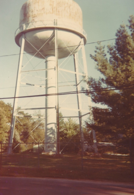
Steel Water Tower from Highland C1978
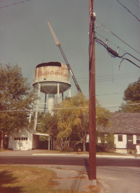
Steel Water Tower from Ferry C1978
“Camel’s Hump” – A Favorite Picnic Spot

Camel’s Hump – A Favorite Picnic Spot
Disasters known as “Freshets” and Fires
This week a brief look at the floods of 1896 and 1936 as well as the Crown Hill Fire in 1930 and how Hudson residents became spectators to these events.

Flood Watching on Iron Bridge 1896
Floods, or ‘freshets’ as referred to by Kimball Webster in his History of Hudson, were common events along the Merrimack River and were recorded in his history of our town. This is particularly true in the bridge area with the mouth of the Nashua River just a few rods to the north. Coupling this with the spring rain fall along with snow and ice melting from the north and west contributes to flooding and the potential for the destruction of property. In the 1800’s notable freshets were recorded in 1818, 1824, 1839, 1841, 1843, 1852, and 1862. In April 1895 a freshet occurred which raised the river to a higher point than any for many years. The east bank of the Merrimack opposite the Nashua River overflowed and covered land along Webster Street.
Our first photograph shows residents of Hudson watching the flood water of the river from the recently constructed iron bridge during the freshet of March 1896. Just before midnight on March 2 the river gained its highest point and began, slowly at first, to recede. The weather turned colder the next day allowing the water to fall very rapidly. At the highest point the water covered all of Webster Street directly west of Kimball Webster’s house. The flood water rose to within six feet, six and one half inches from the underpinning of his house near the front door. Near the iron bridge the surface of the flood was between three and four feet below the floor of the bridge.
On Sunday May 4, 1930, in the early years of the depression, many Nashua residents were suddenly made homeless by a huge fire which destroyed the Crown Hill residential area. This area was East Hollis and Allds Streets eastward to the bank of the Merrimack River, just a short distance south of the Taylor Falls bridge in the area of the railroad bridge.
The blaze began in a trestle of the B & M Railroad where it spanned the Nashua River off Temple Street. High winds escalated the blaze and carried the fire across Temple, down Spruce, and across East Hollis Streets to the Crown Hill area. Fire equipment from surrounding towns in both New Hampshire and Mass. came to assist. Individual residents pitched in with bucket brigades, shovels of dirt, and even blankets. In the end some 400 homes were destroyed and that section of Nashua reduced to wasteland. Most of the property owners had little or no insurance. One year after this disaster more than 400 homes were rebuilt and the area was making a comeback with new zoning and wider streets.

Hudson Residents Viewing Crown Hill Fire 1930
Homes and property in Hudson were protected from the spreading blaze by the Merrimack River; although there were some instances where sparks jumped the river, due to the severe winds, and had to be extinguished. As shown in our second photo, some Hudson residents set up their chairs along the Hudson side of the river and became spectators to the fire.
In March 1936 the most severe flood for this area occurred. By Thursday morning, March 19, the Taylor Falls Bridge was closed to traffic as the banks of the Merrimack were overflowing with tons of water on both sides of the river. At 7:00 A.M. the river was rising at the rate four feet per hour. Residents living near the bridge were forced to evacuate. Officers were stationed at both ends of the bridge to stop traffic.
Families along Webster Street and Litchfield Road were evacuated. The Paradise section near the river (Kenyon, Merrimack and Federal Streets) was completely flooded and the fire department evacuated residents by boats. In the areas mentioned, water rose to the first floor windows.Extensive flooding occurred at all homes along the Webster Street and Litchfield Road.
During the height of the flooding, a log coming down the river did so with such force that it banged head long into the railing of the cement Taylor Falls Bridge. This left a permanent hole in the railing, removing the concrete, and showing only the underlying mesh. From that day until the removal of the bridge, the damage was never repaired. It remained as a reminder of the of the potential force of the river current.

Flood Waters 1936
Again, our fellow residents of town chose to walk on the bridge and observe the flood water barreling into the bridge on it;s north side. Needless to say, this occurred either before or after the height of the flood. Water was ether receding or still trying to reach it’s maximum height. Our third photo shows Hudson residents leaning over the north side of the bridge as the flood water approached the bridge.
B+M Railroad Bridge blasted by Army manuevers – Dec 1942

B+M Railroad Bridge Crossing Into Hudson – 1938
The Worcester, Nashua, and Portland line of the Boston and Maine Railroad began operation through Hudson in 1874 and continued until abandoned in the early 1940’s. The railroad line entered Hudson by crossing the Merrimack River just south of the present Taylor Falls bridge between Nashua and Hudson. The line then took a gradual north and easterly path to Hudson Center and then on to West Windham.
The original wooden railroad bridge was completely destroyed by fire in June 1909 when sparks from an east bound freight train ignited one of the timbers. The resulting blaze was so spectacular that an estimated 1,000 folks in the area watch the blaze against the midnight sky. The destruction of this bridge seriously interfered with the traffic between Worcester and Portland; some 32 trains per day used this bridge daily along the single track line to West Windham and Portland. A temporary bridge was put in place within a week and a replacement steel bridge was completed in record time.
By December of 1942 the days of this line had ended. It was decided to use this steel railroad bridge for army maneuvers. On Saturday December 26, 1942 two preliminary blasts of dynamite were set off near the Nashua side of the bridge. These were staged to acquaint the military unit with the explosives. A detail from Maryland was delegated for this task. According to the Nashua Telegraph the Army Engineers planned at some later time to conduct extensive maneuvers ending with the blowing up of the bridge. According to officials of the railroad, the railroad bridge had been turned over to the U.S. Army about one month earlier.
These explosions occurred without warning to or previous planning with local officials. The first blast consisted of 50 pounds and a second of 150 pounds. Residents of the Crown Hill section of Nashua as well as of the Hudson Bridge area were frightened and hundreds of phone calls were made to police and fire headquarters as well as to the local paper. The resulting explosions rocked houses and blew out hundreds of panes of glass. Many residents were in a near panic and several women were hysterical.
Complaints and protests occurred on both sides of the river. Scores of residents from Crown Hill district reported window broken and other damage. On the Hudson side many windows were blown in and plaster was shaken down in many of the homes. Significant damage was reported to the windows and frames of the Hudson Community Church. The effects of the blasts were felt as far away and Benson’s Animal Farm in Hudson Center.
Needless to say both Nashua and Hudson officials registered their protests through Senators Bridges and Tobey. The senators conducted an investigation into the blasts. Army personnel from Fort Belvoir, MD as well as First Corps Area were called back for the session. First Army Corps of Boston claimed they had no prior knowledge of the maneuvers. No advance warning of the blasts had been given. Much, of the damage and emotions could have been controlled with advance knowledge of the blasts and simply opening the windows just prior to the last. Army officials met with Hudson Selectmen and property owners in order to access the damage. Shortly thereafter forms were provided to the property owners for reimbursement of damages. Reimbursement for at least part of the damages by the U.S. government did occur up to 1 year later.
Once the Senators and officials from Nashua and Hudson learned that these blasts were preliminary to blowing up the bridge with a 500 pound charge at some future time an official protest to further blasting was registered. It was pointed out that it made more sense to salvage the bridge for scrap material for the war effort than to blast it and sink it into the river.
In October 1943 salvaging of the bridge began when Governor of New Hampshire, Robert C. Blood, applied the torch to the first steel girder of the old railroad bridge. In the end, 500 tons of steel were scrapped and turned over to the State Salvage Commission to be used in the making of war materials. By January 1944 the old railroad bridge was gone. All that remains of this bridge today are the old abutments in the river, visible just south of the Taylor Falls Bridge.
This photo is from the Historical Society collection. It shows the railroad bridge during the hurricane of 1938; just a few years before the army maneuvers to blast the bridge. In this photo a train was stationed on the bridge during the hurricane to stabilize the bridge. Details of the blasts, resulting damage, and the probes were reported in the Nashua Telegraph for Monday December 28, 1942.
Webster Street looking North C 1920

Webster St North from Ferry St C 1920
This brings us to this week’s photo of Webster Street, looking north, just after the intersection with Ferry Street C 1920. Along the left of Webster Street are the tracks of the trolley which went north to Manchester. Think of the sharp turn the trolley car(s) made after leaving the bridge, stopping at the transfer station to leave and/or pick up passengers, then making the turn onto Webster street and heading north.
The small building on the left is the grainery which history tells us was also used as the local jail. You may ask what became of the jail? According to the Town Report for the year ending 1918 the town paid Law and Ingham $13.00 to move a safe and cells. Did not state where they were moved from or to. Also, a brief article in the February 19, 1918 edition of the Nashua Telegraph tells us that a young man named Roland Abbott had plans to repair and remodel the building and use it as a club house for the young people of Hudson. It is doubtful that this club house ever became a reality. We do know the building was later moved to Ferry Street, placed on a foundation and used as part of the dwelling at what is now 88 Ferry Street. At the time of this move the property was owned by Nathen Cummings. Some residents of today may remember it as the home of Clayton and Victoria Smith. Photo from the Historical Society Collection.
Aerial View Fulton and Reed Streets C 1955

Aerial View Fulton, Reed, Central Streets C 1955
If you live in the vicinity of Maple Avenue, Reed, Fulton, and Central Street you may well be able to locate your home on this C 1955 aerial photograph. Based upon our accession records at the Historical Society this photo was taken C 1955 from an aircraft owned by Sanders Associates (now BAE Systems of Nashua). The lack of foliage on the trees during the winter months increased the visibility of the buildings from the air. The aircraft was flying in a south easterly direction over this area.
If we look to the left of center the easiest building to locate is the American Legion building at the corner of Central and Fulton Streets at 37 Central. Opposite Fulton at Central is the beginning of Chase Street. We can see the homes from 43 Central westerly toward Maple Avenue and the bridge; including homes to 16 Central Street. The Hudson Community Church (Brick Church) is not shown but you can see the shadow of the church building on Central Street and the home opposite the church. At the time of this photo this home was known as the Dudley/Emerson House; home of Deputy Harry Emerson; a 50 year member of the Hudson Fire Department. In the late 1960’s this home and other homes in the area of Central and Ferry Streets were razed in order to improve access to and egress from the Veteran’s Memorial and New Taylor Falls Bridges. This lot remained empty until 2016 at which time the property was sold and a duplex house is now being built on this site.
Between 27 and 25 Central we see Maple Avenue going southerly past the intersection with Reed Street on the left and on toward what is now Merrill Park on the right and near the edge of the Merrimack River. At the end of Maple Avenue is the remains of the right of way for the steam railroad used by residents to make a connection with the southern end of Fulton Street. Another easy to identify landmark is at the corner of Maple and Reed Street. This house is the former Merrill Family Home. Known to many as the home of Marjorie and Natalie Merrill and a previous site of Hudson’s Town Library.
Returning on Fulton Street towards Central we see most of Reed Street running parallel with Central and extending towards Gillis Street on the upper left of the photo. As we move away from the bridge area we can identify a number of undeveloped lots and open space beyond Gillis and Reed Streets.
One final street to locate is the beginning of School Street just at the intersection with Cummings Street as shown on the lower left in the photo. Easily identified are the homes of Paul and Hazel Buxton and their family on School Street; and the former home of Dr. William Quigley and his family facing the intersection with Cummings Street. The Buxton Family has (and is) serving the town in a number of areas; including Fire Department, Historical Society, and Hills Memorial Library. Dr. Quigley provided medical services to Hudson and Hudson Schools. This photo is from the collection at the Historical Society.
World War II Honor Roll and War Memorial

WW II Honor Roll at Library Park
Soon after the attack on Pearl Harbor in December 1941 the registration of young men for the draft was begun by the Draft Board of Exeter, NH. Registration of Hudson men was held in February 1942 in the lower room of the Hills Memorial Library. Males between 18 and 45 were registered and classified. The total population of our town was then about 3,400.
Members of the American Legion Post No. 48 constructed an honor roll on the east side near Library Street) of Library Park in 1942. As individual men and women entered the service their name was added to the honor roll. As the number of service men increased the initial honor roll board became filled and was replaced by a larger one. The Post Commander, Webster W. White, and a committee of three members, Robert Pratt, Chairman, Paul Buxton, and Harold Farnum with cooperation of the Town Clerk were responsible for the posting of names.The earliest photo shown here is that of the World War II honor roll with some 368+/- names as listed in the Town Report for the year ending January 31, 1944. After the hostilities ended in 1945 this honor roll remained in place on Library Park. Just how long it remained, I am not sure. After it was removed there was no War Memorial for veterans of World War II or any subsequent wars or conflicts until August 1991 when the American Legion erected the present War Memorial.

War Memorial 2016
The Hudson Veterans War Memorial is in honor all who have honorable served in our armed forced, both living and deceased, during all conflicts of our great nation. This project was started in 1989 and authorized by the veterans group in early 1990. Past Post Commander “Billy” Mitchel promoted the original concept, which was further refined by other post members. As with most projects of this magnitude, help from many sources were needed. Mr. James Arsenault designed the center of the monument, Hudson Monument Company was contracted for the stones and artwork. Employees of the Hudson Public Works Department volunteered services for the groundwork, concrete was provided by Brox Industrues, and Hudson Paving Company formed the foundation. The completed memorial was dedicated Sunday August 18, 1991 as part of Hudson’s Old Home Days. Both photos are from the collection of the Historical Society.
Methodist-Episcopal Church

Methodist Episcopal Church C 1912
If you identified this week’s photo as an early picture of the Hudson Community Church, you are partially correct! This photo was taken circa 1910 and at that time this building was the Second Meeting House of the First Methodist Society of Hudson. It was built and dedicated in 1880. So, where was the First Methodist Meeting House and what happened to it?
The Methodist Episcopal Society in Hudson was organized in 1840. For about 10 years prior to that date a number of townspeople were embracing the religious opinions of the Methodists. Many were attending services in Nashua as there was no settled minister in this part of town; and from time to time a Methodist preacher would lecture in Hudson. The interest grew and in 1839 the Rev. Jared Perkins, the Methodist minister from Nashua came to Hudson and lectured in the No 4 schoolhouse, near Blodgett Cemetery. The interest was such that in 1840, at the Annual Methodist Conference, the Rev. Abraham Folsom was placed in charge. He was a man of energy and zeal and he quickly organized a church which would endure and continue for many years to come. Through his efforts $1,250 was raised or pledged for building a house of worship.
First Methodist Meeting House
On August 1, 1840 it was voted to build a meeting house on land donated by Abiather Winn. This plain, modest building 40 x 50 feet was dedicated December 2 of that year. Between Webster’s History and the 1858 map of Hudson; I place this First Methodist Meeting House to have been on the south side of Central Street near the intersection with Melandy Road. This meeting house had 44 pews which were sold at auction; the sale of which raised enough money to pay for the building. The $1,250 raised earlier was returned to the donors. A few years later a small parsonage was built near the south-west corner of the church a cost of $400. This location was inconvenient for the parsonage so a new parsonage lot was secured on the north side of Central Street, east of and adjacent to the Congregational Meeting House which had been build in 1842. Sometime close to 1848 the parsonage building was moved onto that lot and remodeled to include an ell and a small stable. So, the parsonage and church building were near each other on opposite sides of Central Street near Melandy Road.
In 1874 along came the Nashua and Rochester Railroad with the tracks running along Central Street separating the Methodist meeting House from the parsonage even more. This was not just inconvenient, it was dangerous. The church decided move the church to the north side of the highway near the parsonage and on the same lot. At that time the church building was enlarged and rededicated in January 1878.
Disaster struck in August of 1879, a little over 18 months after rededication. On Sunday, August 3, immediately after service a fire broke out in the stable.Both the church and the parsonage were reduced to ashes. If not for the efforts of the Nashua Fire Department, and local townspeople, a number of homes and possibly the Congregational church would have been lost. The buildings were insured for $1,500; less than 1/2 of their real value. This was a severe and nearly fatal blow to the devoted church and society.
Services were temporarily held in a small hall near the bridge owned by James Carnes. Discussions resulted regarding a satisfactory and suitable location for a new house of worship. There was much difference of opinion. Some wanted to rebuild in the same location; others wanted a location nearer the bridge. By this time a number of church members were living on the east side of Nashua. When put to a vote the location of the present brick church, now Hudson Community Church, was chosen. Plans were made and by December 7, 1880 The Second meeting House of the Methodist Episcopal Church was dedicated. It was a 40 x 70 ft building of wood and brick, two stories with a tower spire on the north-east corner.
The parsonage building, also destroyed in the 1879 fire, was not replaced at this time. The church provided whatever housing they could for their pastor. By 1888 a parsonage lot was secured by the church on Baker Street; by the fall of 1894 a parsonage was built. The church contracted with Isaac Newton Smith of Hudson Center as the builder. Cost: less that $2,500.
This church and the women’s organization were was very active in the Hudson Bridge community. During World War I the pastor, Rev. Roy Honneywell took a leave of absence from this church to serve as a chaplain in the US. Army. During the 18 months of his absence The Methodists and The congregationalists united for services in the Methodist Church. As time went on, there was more and more union between the two Protestant churches at the Bridge. As we have learned, the Congregation and the Methodist churches merged in 1930 to form the Hudson Community Church.
The photo of the Methodist Episcopal Church shown here is the one used by Kimball Webster in his History of Hudson. It is from the collection of the Historical Society.
